Grade A4 (Assessment 1 – A4 | Assessment 2 – A4)
Rationale
“Geographic Information System (GIS) and Remote Sensing (RS) technologies continue to develop rapidly and are increasingly regarded as standard ‘professional tools’ in many diverse sectors. Fundamental to their application is the ability of both GIS and RS data-sets to be placed in a unique geographic spatial context, thereby offering practitioners a very powerful and effective decision-making tool within project and/or business management.
This module will serve to develop the understanding and practical skills required to allow students to become competent in the basic use and application of GIS and RS resource material. In addition to class practical and lecture sessions, the module will use case studies, demonstrations and/or visits to illustrate the widespread and versatile applications of GIS and RS systems currently in use.
There is no expectation of prior knowledge of GIS, however the module is based on practice using industry-standard GIS software, so students should be confident in using complex software under written and practical guidance.”
The full module descriptor can be viewed by clicking here.
Assessments
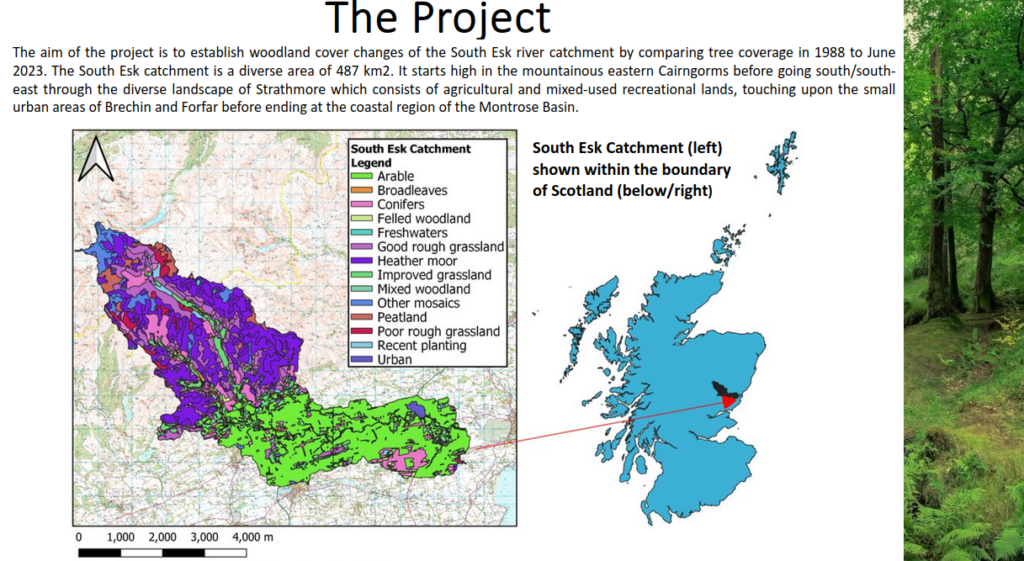
Assessment 1 – Digitising changes to Scotland woodland cover:
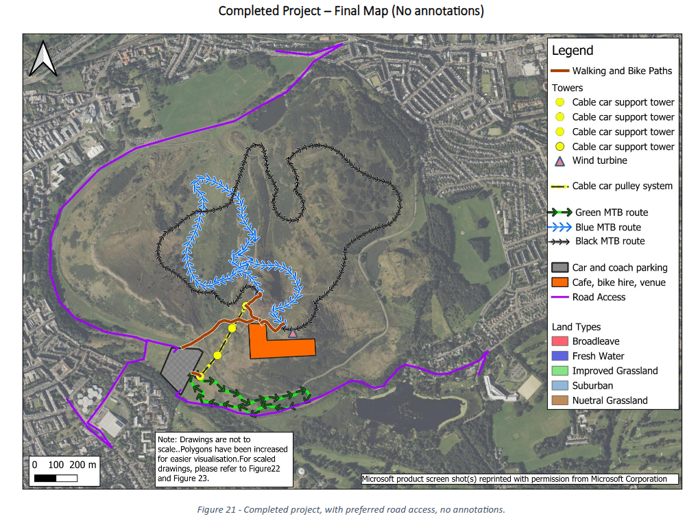
Assessment 2 – Report on mountain bike centre feasibility: